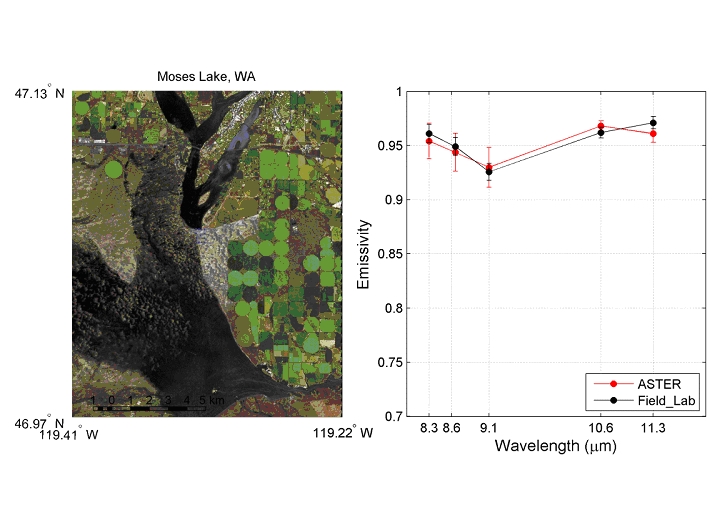
Moses Lake Dunes
The Moses Lake dune field is covers 40 km2 in the Quincy Basin of central Washington southwest of Moses Lake, making up the largest basaltic aeolian sand accumulation on Earth [Petrone, 1970; Edgett and Lancaster, 1993; Bandfield et al., 2002]. The dunes, which are composed of 55% basaltic lithic fragments with lesser amounts of quartz, are thought to originate as sediment deposited in the basin during the floods that forms the channeled scablands [Petrone, 1970] . East and northeast paleo-winds have reworked sands, from the eastern banks of the Columbia River into the current dune forms, which include transverse, parabolic and barchan dunes. West of the Potholes Reservoir the dunes are wet and vegetated, but on the east side of the reservoir the dunes remain active and advance at approximately 3 m/yr [Petrone, 1970] .
