MOD21
MODIS land surface temperature and emissivity (LST&E) standard products (MOD11 from Terra, and MYD11 from Aqua) are generated by three different algorithms: a generalized split -window (GSW) algorithm (MOD11_L2) that produces LST data at 1 km resolution, a day/night algorithm (MOD11B1) that produces LST&E data at ~5 km (C4) and ~6km (C5) resolution, and a product based on the ASTER Temperature Emissivity Separation (TES) algorithm (MOD21_L2) which produces LST and emissivity in 3 MODIS TIR bands (29, 31, 32) at 1 km resolution.
The MOD21 product was developed at JPL and is produced by the ASTER Temperature Emissivity Separation (TES) algorithm that was adapted to work with MODIS bands 29, 32 and 32. The MOD21 product addresses the problem of algorithm inconsistency between sensors, which makes intercomparisons difficult to interpret, introduces uncertainties when resampling data, and limits their usefulness in models and as Earth system data records which require consistent and accurate emissivities over all land cover types at a range of spatial, spectral and temporal scales.
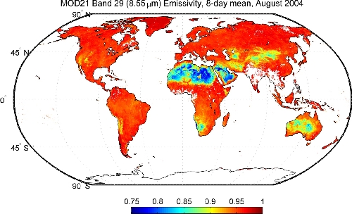
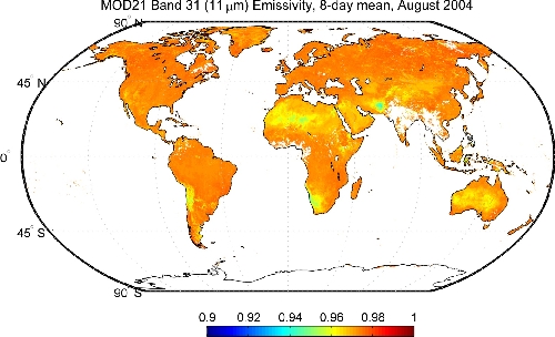
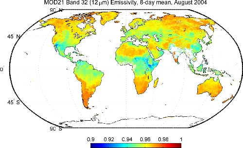
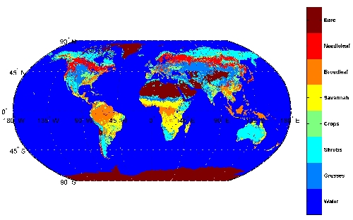
Images below show global MOD21 8-day mean emissivities for bands 29, 31, and 32. Band 29 has the largest variation in emissivity (~0.8-1) since it falls in the quartz reststrahlen band between 8-10 micron, consequently lowest emissivities (blue areas) are found over desert regions due to the abundance of quartz sands. Bands 31 and 32, the so called split-window bands, have more stable emissivities ranging from ~0.92-1. Note that over deserts split-window algorithms set a constant emissivity (~0.96) for bands 31-32 based on classification emissivity (see IGBP map below). Looking at the results from MOD21 below it is clear that there is substantial emissivity variability in bands 31-32 over desert regions, with the result that split-window algorithms (e.g. MOD11_L2) often have large LST uncertainties over arid and semi-arid regions.

.

.

.
