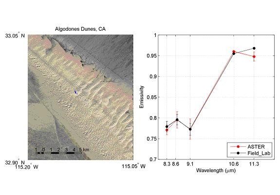
Algodones Dunes
The Algodones Dunes, sometimes called the Glamis dunes, are located along the eastern portion of the Salton Trough near El Centro in the southeastern portion of California. The dunes are approximately 72 km long by 10 km wide, with dunes up to 80 m high and have very little vegetation cover. The prevailing northerly and westerly winds in the area cause the dunes to trend along a northwest-southeast axis [Norris and Norris, 1961] . The Imperial Valley and the Coachella Valley form the elongated, enclosed Cahuilla Basin, which was cut off from the Gulf of California by the formation of the Colorado River. The diversion of the Colorado River in the 1450’s filled the basin to form Lake Cahuilla. Longshore currents moved large volumes of sand from the Whitewater River system at the north end of the lake. The shoreline gradually swings from south to southeast. Wind from the northwest move sand parallel to the beach. The main source of sand, therefore, is deposits from the eastern beaches of Lake Cahuilla, which are composed primarily of quartz and feldspar [McCoy, 1987].

